Insta360 has been doing a good job at rolling out firmware updates lately.

When capturing video for Google Street View, Google recommends using 1 frame per second video for walking, and 5 frames per second for biking and lower speeds. A full 30 or even 60 fps video is unnecessarily huge and will take much longer to upload and process … and most of the frames will be discarded by Google anyway.
I had one of the A.I.s (probably CoPilot) automate using the ffmpeg open source command line tool so I could batch convert files in a directory. A very rough work-in-progress version is on my GitHub now:
I have noticed the A.I.s are starting to put emojis in things — including code and scripts they generate!

I don’t even know how to type emojis in uMacs or VI ;-) but apparently they are supported these days.
Have you noticed the increase in emojis in A.I. responses lately?
I’d end this post with an emoji, but I do not know how to type one in WordPress . . .
UPDATE: There is now a third party reseller offering the DJI Osmo 360 on Amazon, but shipping doesn’t happen until mid-September. Since this is not Amazon shipping or an official DJI storefront, buyer beware. Check reseller ratings before ordering anything.
UPDATE #2: More “confirmation” as I check out Facebook posts. I keep seeing posts from folks who have had access to pre-release review units saying “not available in the US for the foreseeable future.” That is unfortunate. It looks like the Osmo 360 might be better for low-light 360 and I’d get one just for that.
UPDATE #3: According to this REDDIT post, which includes a chat response from DJI, there is no official sale of the DJI Osmo 360 in the USA at this time. BUYER BEWARE of any third party sellers offering it in the USA.
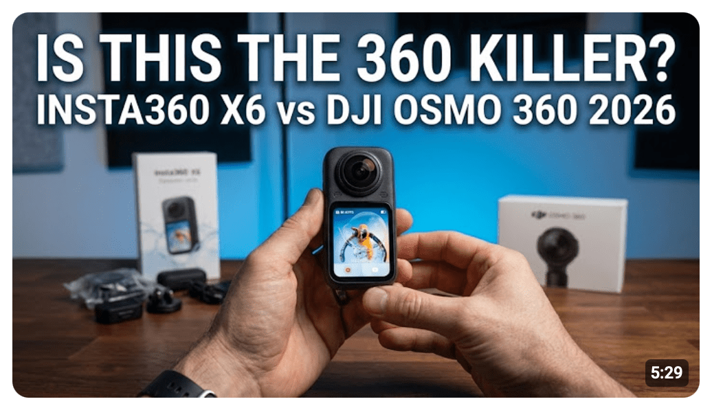
This morning at 7am central time, DJI officially launched their new DJI OSMO 360 camera. But, like almost everything else on the DJI website, it is unavailable in the U.S.A.

This situation was predicted by many DJI followers, based on how almost nothing they sell is currently available to purchase in the U.S.A. Basically no drones, no cameras, and no microphones are being sold to the U.S.A. currently.
The reasons speculated by video bloggers are varied, and are all based on speculation. The two top speculations I have seen include:
Thus, my goal of getting one of these on launch day will be delayed while we figure out if we can get them at all. Instead of a pre-order or long delivery window, they just say “out of stock.” But so does most other things I have spot-checked on the website.
The FOMO is real!
If you get one here in the U.S.A., please leave a comment and tell us where and how you got it. This isn’t even listed on Amazon… yet.
More to come…
Updates:
Recently I posted a list of Google Street View upload errors I have received. I found a way to deal with one of them.
After some “research” (which you can assume means “googling” and “asking A.I.”) I learned that there can be gaps in GPS data that make the movement appear to spike. I found a Mac Store program called GPX Editor which I purchased for the wonderful price of $4.99 so I could look at the data closer:

This program allowed me to look at my data in a much finer (i.e. zoomed in) way than Google Maps does. I could see spikes in the data that looked as if I suddenly popped to another location, as if I went from walking to zooming at 17 mph. This may have been caused by a GPS glitch as I walked under a bridge or some other obstacle that affected the GPS reading.
While you are looking at that screen shot, notice on the right side you can see how much time there is between GPS entries. Google Street View wants 5 seconds or less, I believe, so when gaps appear at 8 seconds, that will also cause an error and the GPX file will be rejected.
Google wants real GPS data, but it seems fixing an obvious glitch like this should be acceptable. Basically, just moving a point back to where it was. I am sure there are tools like GPX Editor that would allow moving one point and fixing it.
But I am lazy, and wondered if there was an easier way.
I ended up looking for a tool to interpolate the GPS data. Here is the one I found:
https://github.com/remisalmon/gpx-interpolate
It will read a GPX file and then smooth out the points. Here is the example screen shot from that Github repository:

The black dots are actually GPS entries, and the red is where it can create new entries. For slow data, such as walking, this should work really well. And, I notice it has the ability to limit how often the data ends up in the file:
usage: gpx_interpolate.py [-h] [-r RES] [-n NUM] [-s] FILE [FILE ...]
interpolate GPX files using piecewise cubic Hermite splines
positional arguments:
FILE GPX file
optional arguments:
-h, --help show this help message and exit
-r RES, --res RES interpolation resolution in meters (default: 1)
-n NUM, --num NUM force point count in output (default: disabled)
-s, --speed save interpolated speed
Side note: To get this running, I had to install a few other things. In order to install them, I had to use some a “virtual environment” for Python so the stuff I installed was isolated from the Python that came with macOS (or so I think). Here were the commands I ran:
cd Movies ***OR WHEREVER YOU WANT TO INSTALL THIS***
python3 -m venv venv
source venv/bin/activate
pip install gpxpy
pip3 install numpy
pip3 install scipy
After that, I could “python3 gpx_interpolate.py -r 1 my_gpx_file.gpx” and get the interpolated file.
The instructions I used (from Google’s A.I.) said I would need to “source venv/bin/activate” each time I started a Terminal and wanted to use this. I will update this as I learn more and understand what this is all about.
Perhaps I could use the “-r” option so it drops a marker every 1 meter or so. As long as I was walking at a regular pace, that should make new data that is much smoother without the jumps and gaps.

This file now seems to have much more consistent entries, and still follows the walking path closely.
I was able to upload the video file and this new interpolated GPX file and it is now live on Google.
But I am sure we can do better. To be continued…
Updates:
This is another research article which I am posting so others may find it in the search engines.
Uploading to Google Street View involves uploading a video file with embedded GPS, or a non-GPS enabled video file and a separate .gpx file containing the GPS data.
Here are some of the errors I have been getting:
This was from two separate recording where the Insta360 GPS Remote did not embed GPS data. Instead, I used a .KML file generated by an iPhone app (Geotag Photos 2) I was using for my digital camera photos. I tried to use the KML file as a backup, but apparently there are data problems in it that Google will not accept.
This one is problematic because the GPX file contains hundreds of GPS points. I had converted my video file down to 1 frame per second, per Google recommendations. One theory was that the points in the GPX file did not line up enough times with a specific frame in the video, and thus the file gets rejected. Google Gemini says this should not matter, but a different file I uploaded at 1 fps did not have any issue, and resubmitting the same erroring file converted to 5 fps did not receive this error.
This was caused when I converted a video file to 1 fps using Apple Compressor. The resulting file had a different creation date, and thus did not match the GPX file. It looks like Apple Compressor cannot be used by itself to get the requested 1 fps, 5fps or other frame rates to Street View.
This one puzzles me the most. If I convert the GPX file to a KML file for uploading to Google Maps…
…that file displays on the map and looks quite accurate to the trail on the map:

This one happened after I used Apple Compressor to reduce the video file down to 5 fps. There are some settings I was told about on Reddit that should allow the metadata to pass through to the converted file. That helped get past an earlier error, but now this one shows up.
This one surprised me since I recorded using a dedicated hardware GPS logger (Columbus P-1 Mark II). This unit appears significantly more accurate than using my phone or a GPS remote. After over a week of processing, I simply was told “Inaccurate GPS.”
Please leave a comment with any solutions to these errors, and I will update this page.
Until then…
Last Updated: 7/20/2025
This is one of my research pages, which means it will be edited and updated as I learn more.
You can use an Insta360 X5 (or other camera) to record 360 video and upload it to Google Street View. After some processing (mine seem to take 3-7 days each) it will appear in Google Street View as a blue line that others can view. Your account name will show up as the uploader. Here is one of my first contributions, documenting some of the bike/walking trails here in Des Moines, Iowa:

You can read more here: https://www.google.com/streetview/contribute/
According to the Google pages, if you upload footage of a “blue line” that is newer than what Google has, they may show your contribution first and previous Google (or user) contributions will show up in the “See other dates” selection:

Google requires and requests a few things:
My workflow using an electric scooter is this:
That has worked for me over the past half dozen attempts, but to save time, converting the mp4 down to 1 fps or 5 fps can be done. I will discuss my steps to do this as soon as I get them working reliably. I converted three files the same way, and Google accepted one, and gave me “Video does not contain more than 10 GPS points. Only 0 GPS points found” errors on the other two. From searching, it seems others are having the same problem — including having Google reject the video a few times, then suddenly accept it later with no changes.
TODO: I will update this with steps using ffmpeg (and a script that helps automate it a bit) and Apple Compressor.
This one is easy, with no special processing or steps needed.
You can also upload 360 photos to any place in Google Maps, such as a business or park. These photos will appear in that entry’s listing under “Photos & videos” in the “Street View & 360” category:

Google used to have a way to upload a PhotoSphere (360 photo) to any location. It would appear as a small blue circle. These could appears inside or outside of a building:

…but I believe this was done through their Street View App which has been discontinued.
You can still upload PhotoSpheres associated with a specific map location by using third party tools, such as this website:
You must log in to your Google account, then you can browse to a 360 photo and upload it. If that photo contains GPS data, the map will show that location. If the photo does not contain GPS data, or the image location was inaccurate, you can manually click to change the location, or type in the LAT and LON to set it.
These will show up quickly, but the blue circles either do not appear any longer, or just take a really long time. A test photo I uploaded can be seen when I look through images of a nearby business, but no blue circle is showing up for me yet.
To be continued…
New features for the X5 have been released.

Many of us were expecting this to be released on the 15th after Insta360 teased something new coming on that date.

Could there be something else coming on the 15th, next week?
Here is a YouTuber with a nice overview of the changes:
Will you upgrade now, or wait a week to see if it has any bugs…?
Until next time.
Per a request, I went back and shot more comparison video of the Insta360 camera in low light conditions. This three minute video contains three sequences, comparing:
The local government is about to tear down some intersection fountain displays, so I have been capturing them in photos and VR. I was hoping to get some night video as well, with the lights on, but the lights may no longer work.
Anyway, here is a recording using fully automatic 360 “Video” mode, versus fully automatic 360 “PureVideo” mode. The 360 video was then exported as a flat video in 4K, then combined as a split screen using Final Cut Pro. The video is shown in horizontal split screen, then again in vertical split.
What do you think?